
Here are six reasons why we think this new map will help make your visit to the trail more fun and rewarding:
- It’s about time! It’s been quite a few years since a new map was created, so we’re proud to get this fresh take out into the world.
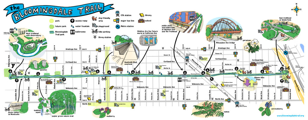
- This map was illustrated by local artist Kayce Bayer, who also made a series of kids activity pages that playfully highlight the natural world up on the trail, such as the trees, bees and a few other hidden gems.
- It is colorful, user-friendly and practical, showing the entire 2.74 miles of the multi-use park, including exactly where you can get on and off the elevated Bloomingdale Trail.
- The map shows existing access parks as well as those on the horizon. It also shows where the Bloomingdale Trail is poised to extend East someday. (We like maps that look to the future!)
- It’s designed as a two-page PDF, it’s easy to view on your mobile device or you can print it out and take it with you on the trail.
- Perhaps most noteworthy, it highlights some of the newer additions to the Bloomingdale Trail… the TOILETS.
Feel free to share this new map with others!